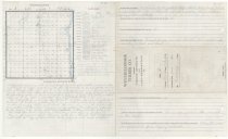
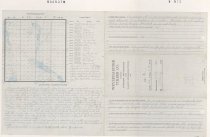
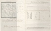
Search Term Record
Metadata
Name |
Snoqualmie River |
Details |
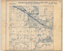
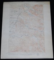
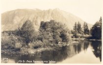
The Snoqualmie River is a 45-mile (72 km) long river in King County and Snohomish County in the U.S. state of Washington. The river's three main tributaries are the North, Middle, and South Forks, which drain the west side of the Cascade Mountains near the town of North Bend and join near the town of Snoqualmie just above the Snoqualmie Falls. After the falls the river flows north through rich farmland and the towns of Fall City, Carnation, and Duvall before meeting the Skykomish River to form the Snohomish River near Monroe. The Snohomish River empties into Puget Sound at Everett. Other tributaries of the Snoqualmie River include the Taylor River and the Pratt River, both of which enter the Middle Fork, the Tolt River, which joins at Carnation, and the Raging River at Fall City. |
Related Records
-
-
-
-
-
-
-
IM.00002 - Snoqualmie Valley History Magazine, 2009 edition. Articles: Families on Horse Back. North Bend in 1909. Then and Now. Goldstar Servicemen. Huck Finns. The Middle Fork Valley Inspires Two Dreams. Poetry Corner. C Beadon Hall: Independent Banker.
Magazine
Record Type: Library

-
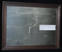
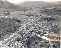
PO.011.0001 - Aerial view of Snoqualmie Falls Lumber Co. View shows mill in upper background and Snoqualmie Falls, Snoqualmie River and Sunset Highway dark in foreground.
Print, Photographic
Record Type: Photo
-
-
PO.017.0154 - The Snoqualmie Falls, color. White water of falls and large rock at brink. Cliffs on either side are very dark. Spray of falls can be seen as water hits ground. Tree tops in lower right.
Print, Photographic
Record Type: Photo
-
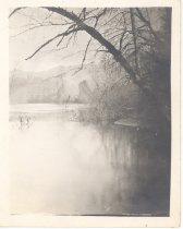
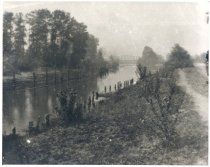
PO.020.0015 - Snoqualmie River with bridge. Scene of river in natural state. Looking toward steel girder bridge in distance. Mountains in background; winder scene, no leaves on trees. Water is high, covering bush to near at left corner. Large tree leaning out over water from bank on right.
Print, Photographic
Record Type: Photo
-
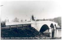
PO.030.0015 - New Bridge over Snoqualmie River at Fall City. Taken following opening of new bridge of concrete. Three arches, solid railing, concrete light standards with globe lights, four across each side. Wooden guardrail on approach to bridge. Taken on right side of bridge approach down the bank on other side of bridge from town.
Print, Photographic
Record Type: Photo
-
PO.030.0199 - The Snoqualmie Falls original lodge, electric power station and bridge. Falls at full flow with much spray at bottom. Snoqualmie Falls Lodge at top of cliff at left. Electric power station across river and foot bridge spans river. Mountains in background.
Print, Photographic
Record Type: Photo
-
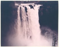
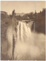
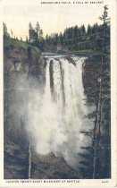
PO.030.0254 - Snoqualmie Falls, A fall of 268 feet. Located twenty-eight miles east of Seattle.
Print, Photographic
Record Type: Photo
-
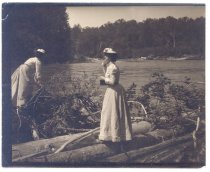
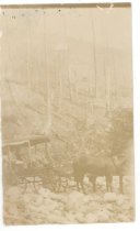
PO.030.0329 - Second ford of the Snoqualmie River on Snoqualmie Pass Wagon Road. Surrey type wagon with large wheels pulled by two horses; two people in back seat crossing very rocky spot in Snoqualmie River. In background is steep hill with snags on hillside. Brush on lower bank beyond horses.
Print, Photographic
Record Type: Photo
-
-
-
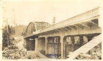
PO.040.3011 - Snoqualmie River Bridge- Washington Federal Aid Project No I42-G I-220' through steel truss with 2-35' and 3-50' concrete approach spans 24' roadway with 2-5' sidewalks. Built in 1931. Cost $72,000. Designed by the Washington State Highway Department
Print, Photographic
Record Type: Photo
-
PO.040.3012 - Snoqualmie River Bridge- Washington Federal Aid Project No I42-G I-220' through steel truss with 2-35' and 3-50' concrete approach spans 24' roadway with 2-5' sidewalks. Built in 1931. Cost $72,000. Designed by the Washington State Highway Department
Print, Photographic
Record Type: Photo
-